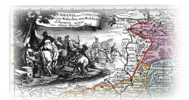
"The Mapping of Ukraine: European Cartography and Maps of Early Modern Ukraine, 1550-1799" Exhibition
The Ukrainian Museum

This event has ended.
The Mapping of Ukraine: European Cartography and Maps of Early Modern Ukraine, 1550-1799, includes 42 original maps published by European mapmakers over a 250-year period. A majority of the maps in the exhibition are from the Museum's Marie Halun Bloch Collection, which consists of 52 maps bequeathed to the Museum by the Ukrainian American writer of children's books upon her death in 1998.
Dr. Bohdan Kordan, the curator of the exhibition, will be on hand for its opening. Dr. Kordan is Professor of International Relations and Chair of the Department of Political Studies, St. Thomas More College, University of Saskatchewan, Saskatoon. He has curated several map exhibitions, including Black Sea, Golden Steppes: Antiquarian Maps of the Black Sea Coast and the Steppes of Old Ukraine (Kenderdine Gallery, University of Saskatchewan, 2001); Land of the Cossacks: Antiquarian Maps of Ukraine (Oseredok, Winnipeg, 1987); and XVII & XVIII Century Maps of Ukraine (Ring House Gallery, University of Alberta, Edmonton, 1985).
A fully illustrated, bilingual catalogue with an introduction by Dr. Kordan will accompany the exhibition. The Mapping of Ukraine: European Cartography and Maps of Early Modern Ukraine, 1550-1799, is scheduled to be on view until October 5.
Media
Schedule
from April 20, 2008 to October 05, 2008